Les agriculteurs commerciaux modernes doivent quotidiennement équilibrer les frais généraux d’exploitation croissants avec les besoins critiques de conservation des sols.. Par conséquent, maximizing seasonal yields requires smarter field allocation strategies across every single acre. Traditional, imprecise planting methods often cause uneven nutrient depletion throughout vast field grids.
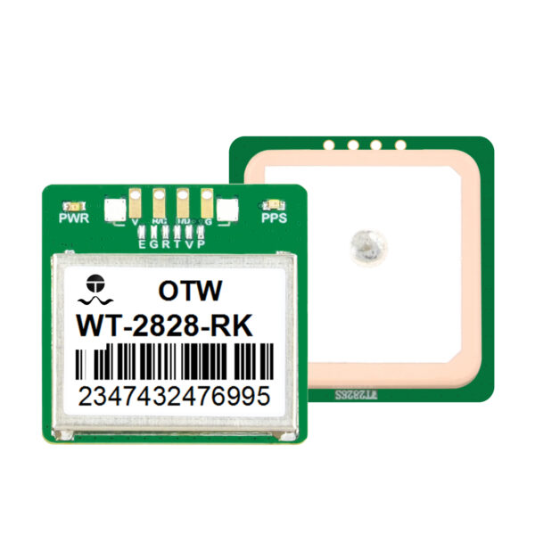
This management challenge explains why progressive growers now deploy a precision farming GPS receiver to handle complex field setups. Utilizing advanced satellite networks allows operators to track specific soil zones with absolute mathematical certainty.
This comprehensive guide details how smart geolocation tracking unlocks superior land use efficiency for diversified farms. We will analyze digital mapping workflows, row management tactics, and sustainable farming ROI parameters.
The Strategic Importance of Sustainable Crop Rotation
Crop rotation serves as a cornerstone of sustainable, high-yield agribusiness management. Alternating deep-rooted crops with nitrogen-fixing plants naturally rejuvenates depleted soil structures over time.
Cependant, manual tracking of shifting seasonal boundaries creates massive logistical headaches for large farming enterprises. If your tractor veers off by just a few inches, you disrupt carefully planned nutrient zones.
[Year 1: Corn Feed] --> Heavy Nitrogen Consumptive Phase
[Year 2: Soybeans] –> Natural Nitrogen Fixation Phase [Required Precision] –> Sub-Inch Alignment via Satellite Lock |
Donc, maintaining strict spatial segregation between different crop families is highly critical. A high-accuracy precision farming GPS receiver prevents accidental overlap between varied crop rows effortlessly. It ensures that your target plants receive the exact soil environment they require to thrive.
Achieving Maximum Land Use Efficiency with Satellite Guidance
Maximizing field space requires growers to eliminate wasted acreage along field edges and headlands. Standard machinery tracking often creates unnecessary gaps or double-seeded overlaps during long working shifts.
Modern smart farming satellite guidance platforms solve this spatial waste by automating complex steering patterns. The system guides heavy machinery along highly optimized path lines, reducing unplanted areas to absolute zero.

En outre, this extreme physical precision directly lowers your seasonal input expenditure. Tractors save fuel by executing fewer corrective maneuvers at the end of each crop pass. This efficient driving style maximizes your total farm output while protecting fragile topsoil layers from heavy compaction.
Integrating Digital Software with Field Hardware
Premium geolocation hardware delivers the best operational results when paired with intelligent data platforms. Modern agronomists utilize specialized crop rotation planning software to design multi-year field schedules.
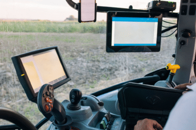
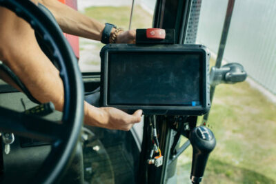
Technicians upload these custom digital field maps directly into the tractor console via secure wireless links. The guidance system then reads the target coordinates to adjust seed distribution patterns instantly across changing topography.
-
Zone Isolation: Keeps chemical spray boundaries strictly separated from organic food plots.
-
Historical Tracking: Saves multiple years of yield history to analyze soil fertility trends accurately.
-
Dynamic Adjustments: Modifies planting density on the fly based on historical soil performance metrics.
-
Boundary Enforcement: Prevents operators from crossing into protected environmental drainage zones accidentally.
Optimizing Equipment Setup for Diverse Fields
Using high-quality connection accessories ensures steady data communication between your vehicle and base networks. Learn more about configuring rugged agricultural transceiver systems to prevent data drops during intense dust storms.
4 Steps to Map Precise Crop Rotations Using GPS
Implementing a satellite-driven rotation protocol requires a systematic technical approach to ensure absolute data consistency.
Overcoming Topographical Challenges and Multipath Delays
Hilly terrain and surrounding tree lines can block standard global navigation satellite signals unexpectedly. When a tractor operates in deep valleys, physical obstacles deflect incoming radio waves, causing temporary positioning lag.
High-end receivers counteract this problem by utilizing multiple satellite constellations simultaneously, comme le GPS, Glonass, et Galilée. Accessing dozens of satellites at once maintains sub-inch accuracy even under partial canopy cover.
[Multiple Satellites] ---> Redundant Signals ---> Stable RTK Correction ---> Pure Precision |
En outre, advanced internal tilt compensation modules adjust positioning data when the tractor leans on steep inclines. This automated calculation ensures the seed drill drops seeds exactly along the planned center line. Read our expert breakdown on adjusting auto-steer calibration parameters to keep your equipment running straight.
Long-Term Benefits of GPS-Driven Agricultural Planning
Transitioning to automated row management delivers massive agronomic advantages that extend far beyond simple steering ease.
D'abord, precise field placement minimizes the necessity for intensive deep tillage over multiple seasons. Because your tractor wheels always follow identical tracking paths, you confine harmful soil compaction to designated lanes. This practice leaves the surrounding seedbeds loose, porous, and highly receptive to root growth.
Deuxième, precise application records help you meet stringent environmental certification standards easily. You can prove your exact chemical history to regulators using verified digital logs. This transparency allows your agribusiness to access premium organic and sustainable food markets globally.
Data-Driven Agriculture Secures Your Future
Can a precision farming GPS receiver truly optimize your seasonal field management? The empirical evidence points to a resounding yes.
By utilizing high-accuracy satellite guidance, you eliminate wasteful row overlaps and maximize your total usable acreage. Integrating your physical hardware with advanced agricultural GIS mapping tools provides total control over multi-year soil health. Do not leave your field productivity to guesswork or outdated manual methods. Invest in professional geolocation systems today to protect your soil assets, boost crop yields, and maximize your farm revenue.