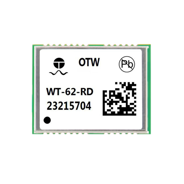
วิศวกรรม IoT สมัยใหม่ต้องการความแม่นยำสูงภายในพื้นที่ขนาดเล็ก. การออกแบบฮาร์ดแวร์ที่ทันสมัยมักจะสร้างข้อเสียเปรียบในการออกแบบ RF ที่ยากลำบาก. วิศวกรต้องดิ้นรนเพื่อรักษาการเชื่อมต่อที่เชื่อถือได้โดยไม่ต้องเพิ่มเทอะทะ. โชคดี, ที่ โมดูล GPS GSM ที่เล็กที่สุด มอบพลังการติดตามที่มีขนาดกะทัดรัดเป็นพิเศษอย่างไร้รอยต่อ. ผสมผสานการรับส่งข้อมูลผ่านมือถือและความสามารถระบุตำแหน่งที่แม่นยำได้อย่างมีประสิทธิภาพ.
ฮาร์ดแวร์ขนาดกะทัดรัดพิเศษนี้มีคุณสมบัติตรงตามมาตรฐานไร้สารตะกั่ว (มาตรฐาน RoHS) เพื่อการผลิตที่ยั่งยืน. นอกจากนี้, ประกอบด้วย RTK ความถี่คู่ขั้นสูงและเทคโนโลยีการนำทางเฉื่อย. เพราะเหตุนี้, วิศวกรสร้างให้เล็กลง, อุปกรณ์ที่ชาญฉลาดยิ่งขึ้นสำหรับสภาพแวดล้อมกลางแจ้งที่มีความต้องการสูง. สำรวจเต็มรูปแบบของเรา หมวดหมู่สินค้า สายเพื่อตรวจสอบเครื่องมือระบุตำแหน่งที่มีความหนาแน่นสูงในวันนี้.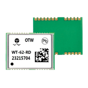
ปัญหาการติดตามที่พบบ่อยในอุปกรณ์ขนาดเล็ก
การออกแบบฮาร์ดแวร์ขนาดกะทัดรัดนำเสนอความท้าทายด้านประสิทธิภาพไร้สายที่ไม่เหมือนใคร. ชิปความถี่เดียวมาตรฐานมักจะล้มเหลวภายใต้สภาวะที่ท้าทาย. วิศวกรมักเผชิญกับปัญหาคอขวดในการปฏิบัติงานหลักสี่ประการในโลกแห่งความเป็นจริงเป็นประจำ.
การปิดกั้นสัญญาณในการเคลื่อนที่แบบไมโครในเมือง
รถสองล้อที่ใช้ร่วมกันทำงานในหุบเขาลึกในเมืองทุกวัน. อาคารสูงสะท้อนสัญญาณดาวเทียม, ทำให้เกิดการรบกวนหลายทางอย่างรุนแรง. เพราะเหตุนี้, ชิปติดตามขั้นพื้นฐานประสบปัญหาการเคลื่อนตำแหน่งที่สำคัญในย่านใจกลางเมือง. ผู้ขับขี่สูญเสียความแม่นยำของการกำหนดขอบเขตตำแหน่งทางภูมิศาสตร์, ทำให้ต้องเสียค่าปรับการจอดรถไม่ถูกต้องอย่างต่อเนื่อง.
การสั่นสะเทือนความเร็วสูงในเครื่องตัดหญ้าแบบหุ่นยนต์
เครื่องตัดหญ้าอัตโนมัติทนทานต่อการสั่นสะเทือนของภูมิประเทศอย่างต่อเนื่องระหว่างการทำงาน. เครื่องรับสัญญาณดาวเทียมมาตรฐานจะสูญเสียการล็อคตำแหน่งภายใต้การเคลื่อนไหวทางกลไกที่รุนแรง. ส่งผลให้, เครื่องตัดหญ้าอัตโนมัติจะเคลื่อนออกไปนอกเส้นแบ่งเขตที่กำหนด. การจัดสวนที่แม่นยำต้องอาศัยความต่อเนื่อง, เครื่องยนต์กำหนดตำแหน่งที่ทนต่อการสั่นสะเทือนอยู่เสมอ.
จุดบอดในคอลเลกชัน GIS ใต้ดิน
นักสำรวจที่รวบรวมข้อมูลการทำแผนที่ GIS เผชิญกับอุปสรรคสัญญาณที่หนาแน่น. ต้นไม้ที่ห้อยลงมา, อุโมงค์, และหุบเขาลึกบังทัศนวิสัยท้องฟ้าโดยสิ้นเชิง. ดังนั้น, เครื่องเทอร์มินัลมือถือแบบทั่วไปสูญเสียการติดตามดาวเทียมภายในสถานที่กำบัง. ทีมงานทำแผนที่เสียเวลาอันมีค่าเพื่อรอการแก้ไขตำแหน่งสตาร์ทเย็น.
ข้อจำกัดด้านพื้นที่ที่รุนแรงในการติดตามอุปกรณ์สวมใส่
เครื่องติดตามตำแหน่งส่วนบุคคลต้องการพื้นที่วางแผงวงจรขนาดเล็กเป็นพิเศษ. โครงสร้างเสาอากาศขนาดใหญ่เพิ่มขนาดอุปกรณ์และการดึงพลังงานอย่างผิดปกติ. ดังนั้น, วิศวกรยอมประนีประนอมกับความแม่นยำในการติดตามเพื่อให้พอดีกับกล่องแบตเตอรี่ขนาดเล็ก. อุปกรณ์นิรภัยที่สวมใส่ได้จำเป็นเร่งด่วนต้องใช้ขนาดไมโคร, เครื่องรับความถี่คู่.
โซลูชั่นทางเทคนิค: เครื่องยนต์ RTK ความถี่คู่หลายระบบ
แพลตฟอร์มกำหนดตำแหน่ง WT-62-RD แก้ไขการเสื่อมของสัญญาณผ่านการบูรณาการ. โดยให้การระบุตำแหน่งทางภูมิศาสตร์และการนำทางที่มีความแม่นยำสูงสำหรับฮาร์ดแวร์ IoT อัจฉริยะ.
การรับสัญญาณความถี่คู่แบบซิงโครนัส 4 ระบบ
เครื่องยนต์ขั้นสูงของเราจะติดตามกลุ่มดาวดาวเทียมหลักสี่ดวงพร้อมกัน. มันประมวลผล GPS (L1C/เอ/L5), BDS (B1I/B2a/B1C), กาลิเลโอ (E1/E5a), และโกลนาส (L1) พร้อมกัน. ดังนั้น, ความพร้อมใช้งานของสัญญาณเพิ่มขึ้นอย่างมากในพื้นที่เมืองที่มีความหนาแน่นสูง. นอกจากนี้, การประมวลผลความถี่คู่ช่วยลดความล่าช้าของบรรยากาศไอโอโนสเฟียร์ในชั้นบรรยากาศโดยอัตโนมัติ.
RTK ความถี่คู่ในตัวและฟิวชั่นการนำทางเฉื่อย
โปรเซสเซอร์ออนบอร์ดรวมอัลกอริธึมดิฟเฟอเรนเชียล RTK โดยตรง. นอกจากนี้, มันมีการนำทางเฉื่อยขั้นสูง (อิน) ซอฟต์แวร์ฟิวชั่น. ดังนั้น, ระบบจะคำนวณตำแหน่งตายตัวอย่างแม่นยำเมื่อสัญญาณดาวเทียมขัดข้อง. การวางตำแหน่งที่รวดเร็วเกิดขึ้นอย่างรวดเร็ว, แม้จะอยู่ในสภาพแวดล้อมที่มีที่กำบังหนาแน่นก็ตาม. อ่านคำแนะนำทางเทคนิคโดยละเอียดของเราเพื่อทำความเข้าใจการรวมอัลกอริธึมที่คำนวณไม่ออก.
ความแม่นยำสูงสำหรับแผนที่คราวด์ซอร์สและ GIS
โมดูลจะสร้างการอัปเดตตำแหน่งระดับเซนติเมตรเพื่อการบันทึกเส้นทางที่แม่นยำ. เพราะเหตุนี้, แพลตฟอร์มการทำแผนที่ที่รวบรวมข้อมูลจากมวลชนจะรวบรวมจุดข้อมูลถนนที่สะอาดอย่างต่อเนื่อง. นอกจากนี้, สถาปัตยกรรมที่ใช้พลังงานต่ำช่วยลดการใช้แบตเตอรี่ในเทอร์มินัลพกพาแบบพกพา. อุปกรณ์ IoT ขนาดกะทัดรัดทำงานได้นานกว่ามากระหว่างรอบการชาร์จในปัจจุบัน.

ข้อกำหนดผลิตภัณฑ์ & การเปรียบเทียบการรับรอง
ตารางด้านล่างเน้นการวัดประสิทธิภาพระหว่างโมดูลมาตรฐานและเครื่องยนต์ WT-62-RD.
| พารามิเตอร์ / คุณสมบัติ | WT-62-RD โมดูล GNSS | โมดูลความถี่เดี่ยวมาตรฐาน |
| กลุ่มดาวที่รองรับ | ซิงโครนัส 4 ระบบ (จีพีเอส/BDS/GAL/GLO) | ระบบ GPS หรือ BDS เดี่ยว |
| คลื่นความถี่ | ความถี่คู่ (L1+L5 / บี1ไอ+บี2เอ / E1+E5a) | วงเดี่ยว (L1 เท่านั้น) |
| การวางตำแหน่งเครื่องยนต์ | RTK ความถี่คู่ในตัว + อินฟิวชั่น | เครื่องยนต์อัตโนมัติ GNSS พื้นฐาน |
| สภาพแวดล้อมที่กำบัง | การวางตำแหน่งที่รวดเร็วผ่าน Inertial Fusion | การได้มาช้า / การสูญเสียสัญญาณบ่อยครั้ง |
| การปฏิบัติตามข้อกำหนดด้านสิ่งแวดล้อม | การปฏิบัติตามข้อกำหนดที่ปราศจากสารตะกั่ว (ได้รับการรับรองมาตรฐาน RoHS) | การปฏิบัติตามมาตรฐานขั้นพื้นฐาน |
| การใช้งานหลัก | ไอโอทีอัจฉริยะ, โดรน, สารสนเทศภูมิศาสตร์, ไมโครโมบิลิตี | การติดตามยานพาหนะของกองทัพเรือขั้นพื้นฐาน |
สถานการณ์การใช้งานที่หลากหลายสำหรับการปรับใช้
สถาปัตยกรรมหลายความถี่นี้รองรับภาคอุตสาหกรรมสมัยใหม่ที่หลากหลายได้อย่างน่าเชื่อถือ.
-
ไอโอทีอัจฉริยะ & แชร์สองรอบ: แพลตฟอร์ม Micromobility ล็อคจุดจอดรถที่แม่นยำในเขตเมือง.
-
แผนที่ที่รวบรวมมวลชน & คอลเลกชันจีไอเอส: นักสำรวจบันทึกจุดภูมิสารสนเทศที่แม่นยำโดยไม่มีสัญญาณขาดหายไป.
-
เครื่องตัดหญ้า & เครื่องจักรการเกษตร: รถแทรกเตอร์อัตโนมัติช่วยให้ผ่านสนามตรงระหว่างงานหนักได้.
-
โดรน & การตรวจสอบการเคลื่อนที่: ยานพาหนะทางอากาศไร้คนขับดำเนินการเส้นทางบินอัตโนมัติที่มั่นคงอย่างปลอดภัย.
-
ยานพาหนะ & การจัดตำแหน่งบุคลากร: อุปกรณ์สวมใส่เพื่อความปลอดภัยขนาดเล็กจะตรวจสอบตำแหน่งของบุคลากรระหว่างการปฏิบัติงานภาคสนาม.
ปรับปรุงโครงการฮาร์ดแวร์ของคุณด้วยความแม่นยำ, เทคโนโลยีการระบุตำแหน่งทางภูมิศาสตร์ที่เชื่อถือได้ในขณะนี้! เรียกดูที่ครอบคลุมของเรา หมวดหมู่สินค้า เพื่อเลือกโมดูลความแม่นยำสูงของคุณวันนี้.