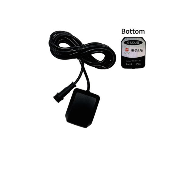
Смена парадигмы: Centimeter Accuracy for Physical AI and Autonomous Fleets
Autonomous drones and field robots are transforming modern industrial logistics today. Recent industry expansions in Physical AI demand absolute spatial certainty for every vehicle. Фактически, standard satellite positioning leaves unmanned platforms vulnerable to dangerous location drifts.
Следовательно, field operators now rely on a compact portable navigation receiver for exact guidance. These lightweight hardware modules process multi-band signals to deliver centimeter-level positioning.
Поэтому, adopting modern UAV precision positioning hardware unlocks unprecedented mission reliability. В этом руководстве, we explore how compact receivers elevate autonomous aerial and ground platforms.
Why Standard Satellite Navigation Fails High-Speed Autonomous Robots
The Lethal Impact of Multi-Meter Position Drift
Traditional single-point GPS positioning usually provides three to five meters of location uncertainty. Однако, high-speed delivery drones cannot operate safely with several meters of positioning error.
A five-meter drift causes a delivery drone to crash into power lines. Сходным образом, an autonomous mobile robot might veer directly off a narrow paved access path.
Более того, cumulative positioning errors disrupt automated landing routines on small charging pads. Because of this, standard consumer-grade receivers fail in professional industrial deployments.
В отличие, advanced robotics GNSS navigation units reduce positional drift down to millimeters. This incredible spatial precision keeps autonomous platforms operating safely along tight waypoint corridors.
Tackling Signal Loss in Urban Canyons and Industrial Sites
Tall concrete buildings and heavy steel structures frequently reflect satellite signals in industrial yards. These reflected signals cause severe multipath interference across standard single-frequency receiving antennas.
Как результат, standard autonomous navigation algorithms suffer from sudden position jumps and signal lockouts. Например, delivery robots traveling through dense city streets lose satellite locks constantly.
Более того, heavy tree canopies in rural areas block direct satellite line-of-sight paths. Modern high-precision receivers solve these environmental signal challenges through advanced filtering technologies.
Конкретно, intelligent signal processors filter out reflected noise before updating the flight controller. Следовательно, autonomous systems maintain stable navigation solutions through harsh electromagnetic environments.
Key Technologies Driving High-Precision Portable Navigation Receivers
Multi-Band Multi-Constellation Signal Tracking
Early navigation chips tracked only the basic GPS L1 frequency band from American satellites. В отличие, a modern portable navigation receiver tracks GPS, Глонасс, Галилео, и Бэйдоу одновременно.
Более того, dual-frequency receivers process L1, Л2, and L5 signal channels concurrently. This multi-band architecture eliminates ionospheric signal delays across long baseline distances.
As a consequence, the receiver locks onto dozens of active satellites at any moment. Кроме того, multi-constellation coverage ensures continuous signal locking beneath partial canopy obstructions.
Поэтому, your autonomous robots maintain accurate heading data even during severe solar weather events.
Real-Time Kinematic Corrections and NTRIP Data Streams
Multi-band tracking alone cannot completely remove atmospheric signal distortion from satellite transmissions. To achieve true centimeter accuracy, systems require real-time differential correction data streams.
This process relies on centimeter level RTK positioning techniques across local networks. Конкретно, a fixed base station measures satellite phase errors at a known geographic location.
Затем, the base sends instant correction data to the rover receiver via cellular NTRIP. Alternatively, long-range LoRa radio links transmit correction packets across remote agricultural fields.
Фактически, receiving RTK corrections reduces spatial positioning uncertainty down to one centimeter. Следовательно, autonomous ground mowers execute parallel cutting passes without overlapping or missing grass.
Anti-Jamming Protection and Sensor Fusion Integration
Industrial job sites often contain powerful radio transmitters and electric motors that disrupt wireless signals. Например, high-voltage power lines emit strong electromagnetic noise that blinds budget GNSS chips.
Modern commercial receivers feature active anti-jamming filters to suppress aggressive RF interference. Более того, advanced systems combine satellite data with inertial measurement units through sensor fusion.
This dead-reckoning integration calculates velocity when satellite signals drop out inside covered loading docks. Как результат, delivery robots navigate seamlessly through indoor and outdoor transitional doorways.
Technical Comparison of Autonomous Navigation Receiver Hardware
Selecting the right receiver hardware directly impacts your autonomous fleet performance and total project costs. Review this technical comparison table to evaluate equipment classes for your autonomous vehicles.
| Performance Category Metric | Consumer Single-Frequency Module | Industrial Dual-Frequency Receiver | High-Precision Multi-Band RTK Module |
| Horizontal Positioning Accuracy | 2.5 meters to 5.0 метры | 0.5 meters to 1.5 метры | 1.0 centimeter to 2.0 сантиметры |
| Cold Start Time-to-First-Fix | 30 seconds to 45 секунды | 20 seconds to 30 секунды | Under 15 секунды |
| Update Refresh Frequency | 1 Hz to 5 Гц | 5 Hz to 10 Гц | До 20 Hz to 100 Гц |
| Anti-Jamming Signal Suppression | Minimal or None | Basic Filtering | Advanced 60 dB Interference Suppression |
| System Weight and Form Factor | Lightweight (Under 10g) | Середина (30g to 50g) | Ultra-Compact SWaP-Optimized (15глин) |
As shown above, upgrading to a multi band autonomous receiver module delivers vastly superior accuracy metrics. Фактически, high update frequencies ensure flight controllers receive fresh location updates every few milliseconds.
Real-World Applications Across Drones and Autonomous Mobile Robots
Sub-Decimeter BVLOS Flight Control for Delivery Drones
Beyond Visual Line of Sight flight operations require rock-solid navigation reliability for long-distance air routes. Regulators require strict flight corridor compliance to grant commercial BVLOS operational approvals.
Equipping delivery UAVs with a compact portable navigation receiver fulfills these stringent safety requirements. Конкретно, onboard flight computers use RTK fixes to follow millimeter-precise 3D flight paths automatically.
Кроме того, centimeter positioning enables safe automatic landing on motorized delivery lockers. Следовательно, logistics companies expand delivery networks while maintaining absolute public safety standards.
Precise Waypoint Navigation for Quadruped Inspection Robots
Industrial quadruped robots inspect hazardous oil refineries and electrical substations on automated schedules. Однако, magnetic interference from heavy steel transformers easily scrambles standard compass sensors.
Dual-antenna navigation receivers solve this problem by providing precise heading data without magnetic compasses. Более того, high-precision positioning guides robot legs onto narrow elevated catwalks safely.
Как результат, autonomous quadrupeds complete inspection routes without falling off steep ledges.
Autonomous Field Operations in Precision Agriculture
Modern agricultural field robots plant seeds and spray liquid fertilizers across massive farming acres. Overlap during chemical spraying wastes expensive fertilizers and damages delicate young crops.
Фактически, using centimeter-accurate RTK positioning eliminates wasteful spraying overlaps entirely. Более того, autonomous tractors navigate straight crop rows with zero manual steering input from operators.
Следовательно, precision farming operations increase annual crop yields while dramatically lowering operating costs.
Future-Proofing Your Robotic Fleet Infrastructure
Emerging Physical AI algorithms require continuous spatial awareness to navigate complex real-world environments safely. Кроме того, international telecommunications companies are expanding continental RTK correction networks rapidly.
These infrastructure investments make centimeter-level positioning accessible across massive geographic regions. Поэтому, integrating high-precision navigation hardware prepares your autonomous fleet for scale.
Более того, modern SWaP-optimized receivers consume minimal battery power on long missions. Следовательно, your drones and ground robots maintain maximum flight times and operational ranges.
Фактически, investing in dual-frequency hardware today prevents expensive vehicle retrofits in future years.
Summary: Elevate Autonomous Navigation Accuracy Today
To sum up, а portable navigation receiver is an essential core component for modern autonomous robotics. Traditional single-band satellite receivers simply cannot deliver the spatial precision required by commercial drones.
By adopting multi-band RTK positioning, you eliminate positional drift and secure centimeter-level flight paths. Кроме того, advanced anti-jamming hardware protects your vehicles against harsh industrial electromagnetic noise.
Do not let poor location accuracy limit your autonomous fleet capabilities. Upgrade your drone and robot navigation systems today to unlock true operational autonomy.