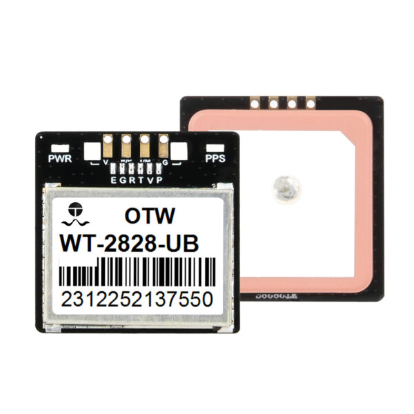
कार्यकारी सारांश: उच्च-परिशुद्धता उपग्रह फील्ड डेटा भौगोलिक स्थानाचे आधुनिकीकरण करतात
प्रगत मॅपिंग डिव्हाइस GPS मॉड्यूल समाकलित करणे एंटरप्राइझ फील्ड ऑपरेशन्सची मागणी करण्यासाठी निर्दोष स्थान ट्रॅकिंग कोऑर्डिनेट्स वितरीत करते. खरंच, लेगसी सिंगल-सॅटेलाईट चिप्सपासून दूर जाण्यामुळे त्रासदायक पोझिशन ड्रिफ्टिंग त्रुटी काढून टाकल्या जातात ज्यामुळे व्यावसायिक सर्वेक्षण डेटा दूषित होतो.
सब-मीटर रीअल-टाइम नेव्हिगेशन ट्रॅकिंग अचूकता प्राप्त करणे हे सुनिश्चित करते की तुमची फील्ड टीम परिपूर्ण वैज्ञानिक आत्मविश्वासाने भौगोलिक मालमत्तेचा नकाशा बनवते.. परिणामी, हे हार्डवेअर अपग्रेड ट्रॅकिंग वर्कफ्लोला गती देते, महाग मॅन्युअल मॅपिंग क्रॉस-चेक काढून टाकते, आणि फील्ड कामगारांच्या सुरक्षिततेचे रक्षण करते.
त्यामुळे, आधुनिक तैनात करत आहे, उच्च-संवेदनशीलता ट्रॅकिंग चिप आजच्या भौगोलिक कंपन्यांसाठी सर्वात फायदेशीर हार्डवेअर निर्णयाचे प्रतिनिधित्व करते. जुन्या ग्राहक-श्रेणी रिसीव्हर्सवर अवलंबून राहिल्याने चुकीचे ट्रॅकिंग पॉइंट्स मिळतात, तुमच्या सर्वेक्षण अहवालाची विश्वासार्हता नष्ट करणे.
हे उलटे विश्लेषणात्मक संक्षिप्त तपशील आमच्या स्थान बुद्धिमत्ता निष्कर्ष प्रथम, नंतर अंतर्निहित अभियांत्रिकी यांत्रिकी शोधते. आम्ही बहु-नक्षत्र प्रक्रियेचे परीक्षण करू, अंतर्गत ॲम्प्लीफायर घटक, आणि खाली कमी-पॉवर ट्रॅकिंग बोर्डचे परिचालन मूल्य.
मल्टी-नक्षत्र GNSS इंजिनद्वारे सिग्नल ड्रॉपआउट्सवर मात करणे
जड वन पानांच्या छताखाली सॅटेलाइट सिग्नल लॉक गमावण्याची तीव्र निराशा प्रत्येक फील्ड टेक्निशियनला समजते. जेव्हा दाट झाडाच्या फांद्या तुमचे थेट आकाश दृश्य अवरोधित करतात तेव्हा मानक ग्राहक ग्लोबल पोझिशनिंग चिप्स त्वरीत डिस्कनेक्ट होतात.
जेव्हा तुमचे मॅपिंग हार्डवेअर कनेक्शन कमी करते, तुमच्या ट्रॅकिंग वर्कफ्लोला फील्डमधील खर्चिक प्रकल्प विलंब सहन करावा लागतो. एकात्मिक बहु-नक्षत्र GNSS इंजिनसह हार्डवेअर प्रणाली वापरणे ही भौगोलिक मर्यादा पूर्णपणे सोडवते.
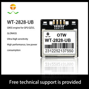
हे बहुमुखी हार्डवेअर इंजिन GPS वरून ट्रॅकिंग सिग्नलवर सक्रियपणे प्रक्रिया करते, QZSS, आणि GLONASS उपग्रह नेटवर्क एकाच वेळी. शिवाय, हे विस्तृत नेटवर्क कव्हरेज तुमच्या उपलब्ध उपग्रहांची संख्या वाढवते, खोल शहरी खोऱ्यांमध्ये अचूक स्थिती राखणे.
तुमचे हँडहेल्ड हार्डवेअर काही सेकंदात स्थिती डेटावर लॉक होते, जगभरातील दुर्गम पर्वतीय भागातही. फील्ड क्रू सातत्यपूर्ण भौगोलिक वेक्टर कॅप्चर करतात कारण ट्रॅकिंग सॉफ्टवेअर तीन स्वतंत्र ग्रहांच्या ॲरेमधून डेटा खेचते.
हाय-गेन एलएनए ट्रॅकिंग हार्डवेअरसह कमकुवत सिग्नल वाढवणे
खऱ्या औद्योगिक सर्वेक्षणासाठी अत्यंत तडजोड केलेल्या सिग्नल वातावरणात निर्दोष अवकाशीय टेलिमेट्री सहजतेने कॅप्चर करणे आवश्यक आहे. धातूची कोठारे, काँक्रीटच्या उंच भिंती, आणि स्थानिक रेडिओ टॉवर सतत गंभीर इलेक्ट्रॉनिक हस्तक्षेप फील्ड तयार करतात.
विशेष हाय-गेन एलएनए ट्रॅकिंग हार्डवेअर तैनात केल्याने तुमच्या येणाऱ्या डेटा प्रवाहांना गोंधळलेल्या स्थिर आवाजापासून संरक्षण मिळते.. एलिट ट्रॅकिंग मॉड्यूल्स एका विशिष्ट पृष्ठभागाच्या ध्वनिक वेव्ह फिल्टरसह अंतर्गत कमी आवाज ॲम्प्लीफायर एकत्र करतात.
ही दुहेरी-घटक अभियांत्रिकी निवड सभोवतालच्या औद्योगिक इलेक्ट्रोमॅग्नेटिक लाटा सक्रियपणे अवरोधित करताना कमकुवत उपग्रह सिग्नलला चालना देते. थेट परिणाम म्हणून, प्रणाली अति-उच्च संवेदनशीलता रेटिंग प्राप्त करते, प्रारंभिक वेळ-टू-फर्स्ट-फिक्स बेंचमार्कला गती देणे.
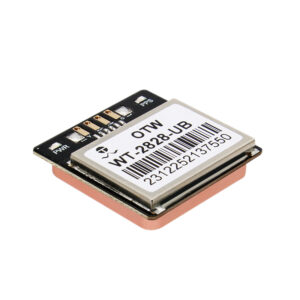
हार्डवेअर ट्रॅक अगदी लहान असले तरीही निर्दोषपणे समन्वय साधतात, लाइटवेट पॅसिव्ह अँटेना केसिंगच्या आत टेकलेला. कव्हर केलेल्या कन्स्ट्रक्शन झोनमध्ये तुम्हाला उत्कृष्ट पोझिशनिंग परफॉर्मन्स मिळते जेथे मानक नेव्हिगेशन टूल्स पूर्णपणे अयशस्वी होतात.
लो-पॉवर GPS मॅपिंग चिप वापरून रिमोट मिशन्सचा विस्तार करणे
फील्ड मॅपिंग टीम अनेकदा इलेक्ट्रिकल चार्जिंग ग्रिडमध्ये प्रवेश न करता दुर्गम वाळवंट भागात काम करतात. भारी, पॉवर-हंग्री नेव्हिगेशन उपकरणे डिव्हाइसच्या बॅटरी वेगाने काढून टाकतात, संघांना अस्ताव्यस्त सोलर चार्जिंग पॅनेल घेऊन जाण्यास भाग पाडणे.
तुमचा ताफा एका विशेषीकृतमध्ये श्रेणीसुधारित करत आहे लो-पॉवर जीपीएस मॅपिंग चिप तुमच्या फील्ड ऑपरेशनल विंडोला नाटकीयरित्या विस्तारित करते. हे मायक्रो-इंजिनियर केलेले सिलिकॉन बोर्ड बॅटरीचा वापर कमी करण्यासाठी प्रगत स्टँडबाय अल्गोरिदम वापरतात..
-
पोझिशनिंग मॉड्यूल आणि अँटेना इंटिग्रेटेड: सैल अंतर्गत कनेक्शन वायर पूर्णपणे काढून टाकताना एकूण भौतिक उपकरणाचा आकार कमी करते.
-
अपवादात्मक जॅमिंग प्रतिकारशक्ती: स्थानिक सेल्युलर फोन टॉवर्सवरील भटक्या सिग्नलकडे दुर्लक्ष करण्यासाठी सक्रिय फिल्टरिंगचा वापर करते.
-
अति-उच्च संवेदनशीलता मॅट्रिक्स: जड ढगांच्या आवरणातून आणि हिवाळ्यातील हिमवादळांमधून कमकुवत ट्रॅकिंग बीम पटकन शोधते.
-
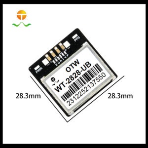
कॉम्पॅक्ट हार्डवेअर फूटप्रिंट: ऑपरेटरसाठी अनावश्यक शारीरिक ताण न जोडता हलक्या वजनाच्या हँडहेल्ड डेटा कलेक्टर्समध्ये बसते.
तुमचे स्थान कॅलिब्रेट केल्याने बॅटरी वाचवण्यासाठी रिफ्रेश होते
ट्रॅकिंग अचूकता आणि ऊर्जेचा वापर यांच्यातील परिपूर्ण संतुलन साधण्यासाठी तुमची स्थिती अपडेट अंतराल समायोजित करणे आवश्यक आहे. लांब वाळवंटातील मोहिमांमध्ये तुमचा हँडहेल्ड डिव्हाइस रनटाइम वाढवण्यासाठी स्थानिक अद्यतन दर कॉन्फिगर करण्याबद्दल अधिक जाणून घ्या.
मल्टी-पाथ हस्तक्षेप आणि ट्रॅकिंग समन्वय त्रुटी मिटवणे
उंच रिफ्लेक्टिव्ह गगनचुंबी इमारतींमधून उपग्रह सिग्नल्स बाउन्स केल्याने एक धोकादायक मॅपिंग घटना निर्माण होते ज्याला बहु-पाथ हस्तक्षेप म्हणतात.. हे विलंबित रेडिओ प्रतिध्वनी मानक पोझिशनिंग अल्गोरिदम गोंधळात टाकतात, ज्यामुळे तुमचा ऑन-स्क्रीन नकाशा पिन अनियमितपणे उडी मारतो.
सुदैवाने, आधुनिक सक्रिय कम्युनिकेशन चिप्स इनकमिंग टेलिमेट्री स्क्रब करण्यासाठी प्रगत गणितीय मल्टीपाथ सप्रेशन फिल्टर्स वैशिष्ट्यीकृत करतात. ट्रॅकिंग सॉफ्टवेअर सिग्नल येण्याच्या वेळेचे विश्लेषण करते, तुमच्या ट्रॅक लाईन्स सरळ ठेवण्यासाठी विकृत प्रतिध्वनी लहरी टाकून द्या. आज तुमच्या अवकाशीय डेटा ॲरेचे संरक्षण करण्यासाठी बहु-पथ विकृती दूर करण्यासाठी आमचे तांत्रिक मार्गदर्शक वाचा.
याव्यतिरिक्त, तुमचे फील्ड ट्रॅकिंग सर्वेक्षण सुरू करण्यापूर्वी तुमच्या आसपासच्या अँटेना ग्राउंड प्लेन सेटिंग्जकडे बारकाईने पहा. तुमचे हार्डवेअर केसिंग पुरेसे अंतर्गत कॉपर शील्डिंग वापरत असल्याची खात्री केल्याने मदरबोर्ड इलेक्ट्रॉनिक स्टॅटिक रिसीव्हरला आंधळे करणे थांबवते.
एंटरप्राइझ लोकेशन इंटेलिजेंस सिस्टम्सचा व्यावसायिक परतावा
प्रीमियम भौगोलिक ट्रॅकिंग हार्डवेअरमध्ये गुंतवणूक केल्याने कालांतराने लॉजिस्टिक व्यवसायांचा विस्तार करण्यासाठी मोठ्या प्रमाणावर दीर्घकालीन आर्थिक फायदे मिळतात. यशस्वी फील्ड ऑपरेशन्स मॅनेजर एकूण डेटा संकलन जीवनचक्र खर्चाची गणना करण्यासाठी स्वस्त घटकांच्या किंमती पाहतात.
प्रथम, निष्कलंक स्थान ट्रॅकिंग अचूकता तुमच्या फील्ड तपासणीची वेळ कमी करते, एकूण श्रम खर्च कमी करणे. जेव्हा पहिल्या भेटीत तुमचे नकाशे बरोबर असतात, चुका दुरुस्त करण्यासाठी तुम्ही महागड्या परतीच्या सहली पूर्णपणे काढून टाकता. ही कार्यक्षमता तुमच्या कडक ऑपरेशनल बजेटचे संरक्षण करते.
दुसरा, लो-पॉवर हार्डवेअर लेआउट्स तुमच्या फील्ड गियरचा भौतिक आकार कमी करतात, आपल्या क्रूला अत्यंत मोबाइल ठेवणे. तंत्रज्ञ खडबडीत प्रदेशातून वेगाने पुढे जातात, विक्रमी वेळेत विस्तारित पाइपलाइन मॅपिंग कार्ये पूर्ण करणे.
आजच तुमची स्थानिक डेटा अचूकता वाढवा
आमच्या मूळ विश्लेषणाकडे वळून पाहतो, भौगोलिक स्थान डेटा उच्च-संवेदनशीलता ट्रॅकिंग मॉड्यूल पूर्णपणे महत्त्वपूर्ण असल्याचे सिद्ध करतो. कमी-दर्जाच्या घटकांपासून दूर जाणे त्रासदायक लोकेशन ड्रिफ्ट काढून टाकते जे मौल्यवान कंपनी ट्रॅकिंग अहवाल दूषित करते.
एलिट मॅपिंग डिव्हाइस GPS मॉड्यूल निवडून, तुम्ही तुमच्या फील्ड डेटा संकलन मालमत्तेवर पूर्ण नियंत्रण ठेवता. सत्यापित वर अवलंबून रिअल-टाइम नेव्हिगेशन ट्रॅकिंग शुद्ध अवकाशीय निर्देशांक कॅप्चर करताना तुमचे कर्मचारी सुरक्षितपणे काम करतात याची खात्री सिस्टम करते. तुमचा डेटा सुरक्षित ठेवण्यासाठी आजच व्यावसायिक दर्जाच्या मल्टी-नक्षत्र ट्रॅकिंग सिस्टममध्ये गुंतवणूक करा, तुमचा वर्कफ्लो ऑप्टिमाइझ करा, आणि आपल्या बाजाराचे नेतृत्व करा.