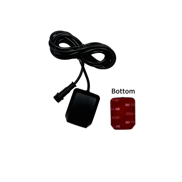
Tailored GNSS Hardware Solves Multipath Drift and Secures Absolute Positioning Truth
Deploying a highly specialized custom GPS receiver immediately resolves severe position drift bottlenecks for modern industrial applications. This strategic engineering asset guarantees true centimeter-level coordinate accuracy while expanding your baseline mapping workflows significantly.
Standard off-the-shelf tracking chips fail to maintain stable positioning links under dense urban tree canopies. Conversely, customized multi-frequency hardware modules track multiple global satellite constellations simultaneously to bypass local atmospheric distortions completely.
Furthermore, tailored electronic interfaces allow your engineering team to integrate specialized sensors into a single compact board. Ultimately, upgrading your positioning infrastructure eliminates costly signal dropouts while securing absolute operational control across demanding autonomous vehicle fleets. Now, let us track back to evaluate the severe signal limitations that generic consumer satellite receivers face.
The Multipath Bottleneck: Why Generic Tracking Chips Fail High-Precision Commercial Projects
Every experienced hardware engineer understands the deep frustration of reading erratic location coordinates during field testing. These costly data tracking errors usually happen because standard consumer navigation chips fail to filter out reflected radio signals.
How Dense Urban Canyons Corrupt Standard Satellite Data Links
Standard navigation devices receive raw radio signals that bounce off glass skyscrapers and metallic industrial warehouses. Consequently, these delayed signal reflections create massive multipath interference patterns, confusing the internal calculation engine completely.
This digital distortion shifts your real-time tracking points by several meters, throwing autonomous vehicles off course completely. Therefore, fixing these dangerous tracking jumps requires upgrading to a specialized precision GNSS mapping module architecture immediately.
Why Rigid Generic Layouts Block Crucial Robotic Sensor Integration
Standard retail positioning boards feature fixed communication protocols that limit your external data interface options tightly. When your team attempts to connect advanced inertial measurement sensors, the generic hardware processor chokes under the load.
As a result, your research teams spend endless hours writing complex code workarounds to patch the connection gaps. Therefore, integrating a high-performance multi frequency RTK receiver model becomes completely vital to streamline heavy sensor data streams.
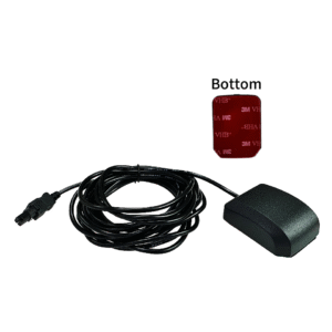
Technical Core: Inside the Architecture of High-Accuracy Custom Positioning Engines
To conquer complex environmental challenges, satellite navigation engineers completely overhauled traditional radio frequency processing circuits. Modern customized positioning boards combine multi-band patch antennas with local real-time kinematic processing algorithms to maximize coordinate truth.
Harnessing Multi Frequency Band Tracking for Fast Correction
Elite custom boards utilize specialized internal processing channels that catch L1, L2, and L5 satellite signal frequencies simultaneously. This multi-band access allows the internal processor to calculate and eliminate ionospheric signal delays in real time.
Consequently, the smart system locks onto stable satellite positions within seconds, maintaining solid data links over vast distances. Your field surveying crews enjoy crisp, repeatable mapping coordinates, remaining fully productive throughout their entire outdoor assignment.
The Decisive Engineering Advantages of a Customized Dual Band Positioning Board
Commercial autonomous vehicle management requires rugged, highly flexible positioning hardware to secure reliable tracking across changing field environments:
-
Real Time Kinematic Engines: Process local correction data streams rapidly to drop positioning error margins down to millimeters.
-
Constellation Agility Configurator: Switches between GPS, GLONASS, Galileo, and BeiDou networks automatically to guarantee maximum sky visibility.
-
Raw Measurement Output Plugs: Provide unfiltered pseudorange data files directly to your internal custom software programs.
-
Low Power Consumption Profiles: Save precious battery reserves to keep remote environmental tracking sensors alive for months.
Performance Matrix: Generic Navigation Chips vs. Custom Precision GNSS Receivers
| Positioning Quality Metric | Generic Commercial Navigation Chips | Custom Precision GNSS Receivers |
| Accuracy Baseline Range | Poor (Often drifts three to five meters away) | Perfect Absolute (Maintains centimeter accuracy easily) |
| Signal Lock Recovery Speed | Slow (Takes minutes to recover inside tunnels) | Instantaneous (Re-locks onto satellites within seconds) |
| Sensor Fusion Adaptability | Non-Existent (Locks you into fixed hardware pins) | Complete (Integrates IMU and wheel odometry smoothly) |
| Multipath Filtering Power | Weak (Fails completely around tall buildings) | Exceptional (Advanced mathematical models block reflections) |
| Firmware Modifiability | Locked (Cannot adjust internal tracking algorithms) | Open Architecture (Tailors code parameters to your needs) |
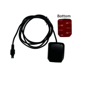
Strategic Project Benefits: Accelerating Field Workflows and Securing Enterprise Asset Data
Integrating a professional custom GPS receiver onto your industrial equipment delivers immediate, compounding operational returns. This structural hardware upgrade converts a simple tracking component into a highly effective tool that drives field efficiency.
Boosting Surveying Speeds via Real-Time Kinematic Correction Streamlining
Every time your field technician boots up an upgraded custom tracking board, it syncs with local base stations instantly. Your mapping teams can collect highly precise topographical data points without setting up clumsy manual reference lines on-site.
This rapid digital recording process cuts your field asset surveying timelines by more than half. This speed acceleration drops your project labor costs dramatically, driving higher net profitability across your engineering division.
Future-Proofing Autonomous Fleets via Advanced Inertial Sensor Fusion
Modern industrial drone brands utilize smart sensor fusion to minimize positioning losses inside tight, covered spaces. High-capacity custom boards blend satellite tracking records with real-time data coming from onboard gyroscope sensors seamlessly.
Your flight software can calculate exact vehicle trajectories even when passing directly under massive steel bridges. This continuous tracking safety shields your expensive autonomous assets from catastrophic crashes, expanding your fleet operational lifespan significantly.
Operations Protocol: Deploying Custom Positioning Boards for Peak Field Performance
Securing perfect coordinate accuracy requires executing your hardware integration according to strict radio frequency planning rules. Ensure your development engineering teams follow this mandatory technical sequence before finalizing your custom equipment enclosure designs.
-
Isolate High Frequency Noise: Place your GNSS module far away from noisy onboard computer processors.
-
Static Antenna Ground Planes: Mount a metallic shielding plate directly underneath your patch antenna to stop ground reflections.
-
Configure Correction Data Inputs: Setup a stable cellular link to feed RTCM correction streams to the board.
-
Calibrate Inertial Measurement Sensors: Run the vehicle through a series of figure-eight maneuvers to align internal sensors.
Following this straightforward installation protocol prevents expensive signal dropouts and avoids post-launch coordinate drift across your fleet. It establishes an unshakeable hardware foundation, allowing your commercial robotic systems to handle complex field mapping tasks flawlessly.
FAQ:
How does a high accuracy surveying GPS engine eliminate signal tracking noise?
Advanced high accuracy surveying GPS engines utilize specialized narrow-correlator chip designs that analyze incoming radio waves at ultra-high speeds. This rapid scanning allows the internal mathematical processor to distinguish between direct satellite signals and delayed ground reflections cleanly. The system discards the corrupted noise waves instantly, utilizing only pure line-of-sight data to compute your exact physical position.
Why are multi frequency RTK receiver modules better than standard single band devices?
Modern multi frequency RTK receiver modules capture multiple distinct radio bands from the same satellite vehicle simultaneously. This redundant data access allows the receiver to calculate the exact signal delay caused by changing atmospheric moisture conditions. Single-band chips cannot perform these advanced equations, leaving your coordinates vulnerable to massive tracking errors during heavy storms.
What is the average engineering timeline to build a customized dual band positioning board?
Designing and manufacturing a tailored positioning board package typically takes between eight and twelve weeks from initial schematics. Engineering teams spend the first month optimizing the electrical tracing pathways to match your specific chassis size requirements perfectly. Then, factory technicians assemble the prototype modules and run rigorous thermal vibration tests to ensure maximum outdoor survivability.
Can our existing industrial drone software communicate directly with a custom receiver board?
Yes, elite custom receivers use flexible, open-source communication protocols that talk to popular industrial robotic systems easily. Your programming team can adjust output data rates up to twenty hertz to feed rapid position updates straight into your flight controller. This high-speed communication link minimizes steering lag, keeping your autonomous aircraft perfectly stable during high-wind mapping missions.
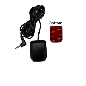
Secure Your Market Position with Elite Positioning Hardware
Relying on weak, generic navigation chips leaves your autonomous vehicle project highly vulnerable to tracking errors and field failures. You cannot build an elite industrial brand image if coordinate drift constantly disrupts your robotic mapping routines. Upgrading your equipment infrastructure to utilize a premium custom GPS receiver transforms your technical capabilities completely. This strategic investment combines robust multi-frequency tracking chips with open-architecture firmware to protect your autonomous navigation streams.
Stop letting urban dead zones and weak patch antennas limit your project accuracy metrics this development season. Invest in field-proven, low-maintenance custom GNSS modules that maximize your coordinate speeds and deliver pristine millimeter-level accuracy. Your engineering crews will love the flexible sensor integration, and your clients will love the rock-solid positioning stability. Modernize your hardware technology framework today to take absolute control over your brand’s digital tracking standards.