โครงการก่อสร้างสมัยใหม่ต้องการความแม่นยำสูงสุด. จากเค้าโครงไปจนถึงการจัดตำแหน่งโครงสร้าง, ข้อผิดพลาดแม้แต่สองสามเซนติเมตรก็สามารถนำไปสู่การทำงานซ้ำที่มีค่าใช้จ่ายสูงได้. นั่นคือสิ่งที่ RTK จีพีเอส (ระบบกำหนดตำแหน่งบนโลกจลนศาสตร์แบบเรียลไทม์) เทคโนโลยีก้าวเข้ามา - ปฏิวัติวิธีที่วิศวกรและนักสำรวจวัดผล, จัดตำแหน่ง, และควบคุมสถานที่ก่อสร้าง.
RTK GPS คืออะไรและทำงานอย่างไร?
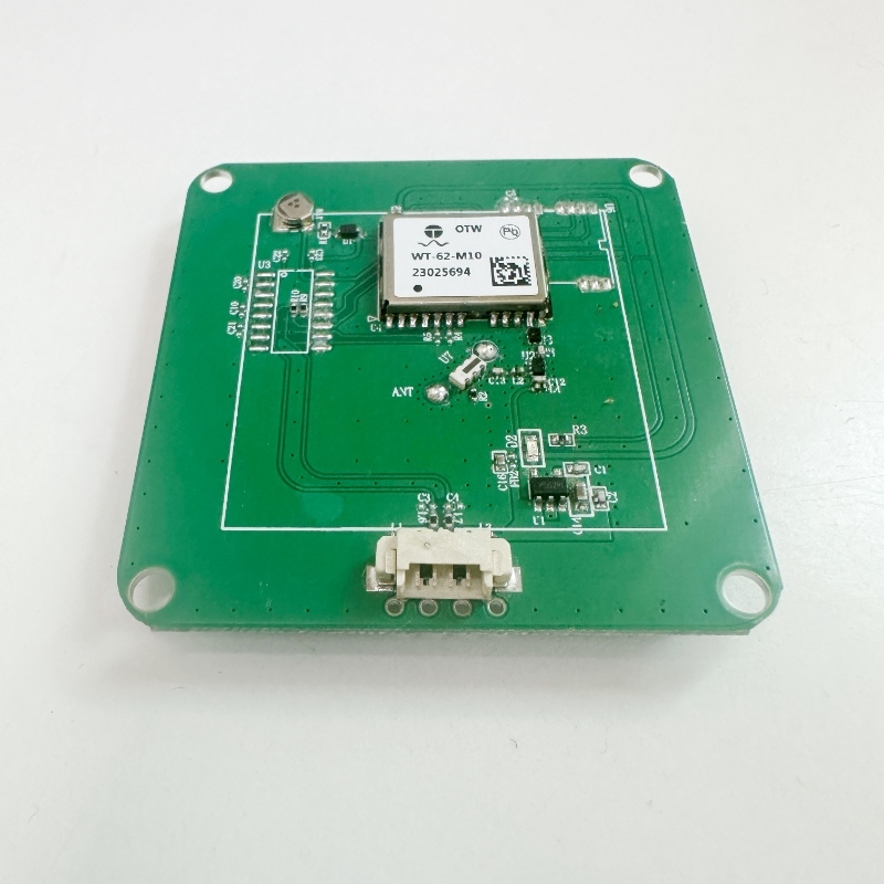
RTK GPS ใช้สัญญาณดาวเทียมและสถานีฐานแบบตายตัวในการส่งมอบ ความแม่นยำของตำแหน่งระดับเซนติเมตร แบบเรียลไทม์.
แตกต่างจาก GPS แบบดั้งเดิม, ซึ่งอาจลอยไปหลายเมตร, RTK GPS แก้ไขข้อผิดพลาดของสัญญาณทันทีผ่านข้อมูลส่วนต่าง.
ส่วนประกอบหลักของระบบ RTK
-
สถานีฐาน: การอ้างอิงแบบตายตัวที่ส่งสัญญาณการแก้ไข.
-
หน่วยโรเวอร์: เครื่องรับสัญญาณเคลื่อนที่ที่นักสำรวจใช้ในสถานที่.
-
ลิงค์การสื่อสาร: ส่งข้อมูลแบบเรียลไทม์ระหว่างฐานและรถแลนด์โรเวอร์.
เมื่อรวมกันแล้ว, ส่วนประกอบเหล่านี้ช่วยให้พนักงานภาคสนามสามารถวางตำแหน่งอุปกรณ์ได้, ตรวจสอบขอบเขตของไซต์, และดำเนินงานเค้าโครงด้วยความแม่นยำที่ไม่มีใครเทียบได้.
เหตุใดความแม่นยำจึงมีความสำคัญในการวัดการก่อสร้าง
ข้อผิดพลาดในการก่อสร้างอาจทำให้เกิด:
-
การวางแนวโครงสร้างไม่ตรง
-
ขยะวัสดุมากเกินไป
-
ความล่าช้าในระยะเวลาของโครงการ
-
ต้นทุนการทำงานซ้ำสูง
แม้แต่ก 2 ส่วนเบี่ยงเบนซม. อาจทำให้ฐานรากวางผิดที่หรือส่งผลต่อโครงสร้างรับน้ำหนัก. RTK GPS ช่วยลดความเสี่ยงดังกล่าวโดยส่งมอบอย่างต่อเนื่อง, ข้อมูลตำแหน่งที่มีความแม่นยำสูงทั่วทั้งโซนการก่อสร้างขนาดใหญ่.

RTK GPS ลดข้อผิดพลาดในการวัดได้อย่างไร
1. การแก้ไขแบบเรียลไทม์เพื่อความแม่นยำของตำแหน่ง
RTK GPS สำหรับการสำรวจโครงการจะแก้ไขข้อผิดพลาดในการระบุตำแหน่งจากสัญญาณดาวเทียมอย่างต่อเนื่อง.
ระบบประมวลผลการแก้ไขตามเวลาจริงจากสถานีฐาน, ลดข้อผิดพลาด GPS มาตรฐานจากเมตรเป็นเซนติเมตร.
2. ปรับปรุงความสอดคล้องของข้อมูลทั่วทั้งทีม
ในโครงการก่อสร้างขนาดใหญ่, หลายทีมมักจะทำงานพร้อมกัน. RTK ช่วยให้มั่นใจว่าทุกการวัดอ้างอิงถึงพิกัดฐานเดียวกัน, การรักษาข้อมูลที่สอดคล้องกันในการสำรวจ, การขุดค้น, และขั้นตอนการจัดวาง.
3. การควบคุมอุปกรณ์และระบบอัตโนมัติที่ได้รับการปรับปรุง
รถขุดสมัยใหม่, นักเรียนระดับประถม, และเครื่องปูผิวทางรวม RTK GPS เพื่อการควบคุมอัตโนมัติ.
สิ่งนี้ทำให้มั่นใจได้:
-
ตรง, พื้นถนนระดับ
-
ความลึกของรากฐานที่แม่นยำ
-
ลดความจำเป็นในการสำรวจซ้ำด้วยตนเอง
4. ประหยัดเวลาในการทำงานซ้ำและการตรวจสอบ
วิธีการแบบเดิมๆ จำเป็นต้องมีการตรวจสอบความถูกต้องบ่อยครั้งโดยใช้สถานีทั้งหมด.
พร้อม RTK GPS, ทีมงานภาคสนามจะตรวจสอบผลลัพธ์ทันที, ลดเวลาในการสำรวจได้ถึง 50% และลดการหยุดทำงานที่มีค่าใช้จ่ายสูง.
5. บูรณาการกับระบบ UAV และ GIS
RTK GPS ยังรองรับ การสำรวจโดยใช้โดรน, บันทึกข้อมูลภูมิประเทศที่มีความละเอียดสูง.
การบูรณาการนี้ช่วยปรับปรุงการทำแผนที่ดิจิทัล, การตรวจสอบสถานที่, และติดตามความคืบหน้าการก่อสร้าง.
แอปพลิเคชั่น RTK GPS ในอุตสาหกรรมก่อสร้าง
การสำรวจที่ดินและแผนผังไซต์
RTK GPS เร่งการสำรวจภูมิประเทศ, การตรวจสอบขอบเขต, และการปรับระดับพื้นดินเบื้องต้น.
โครงการโครงสร้างพื้นฐานและโยธา
ในถนน, ทางรถไฟ, และโครงการสะพาน, RTK GPS รับประกันการควบคุมระดับความสูงและเกรดที่ถูกต้อง.
การแนะนำเครื่องจักรและระบบอัตโนมัติ
เครื่องจักรกลหนักที่ติดตั้งเครื่องรับ RTK เป็นไปตามรูปแบบการออกแบบที่แน่นอน, ปรับปรุงประสิทธิภาพการผลิตและลดข้อผิดพลาดของมนุษย์.
การทำแผนที่ UAV สำหรับการติดตามความคืบหน้า
เมื่อจับคู่กับ UAV, ระบบ RTK มอบแผนที่ทางอากาศที่แม่นยำสำหรับรายงานความคืบหน้าการก่อสร้างและเอกสารการปฏิบัติตามข้อกำหนด.
เหตุใดจึงเลือกโซลูชั่น Ontheway RTK GPS?
การเลือกผู้ให้บริการระบบ RTK ที่เชื่อถือได้มีความสำคัญพอๆ กับการเลือกเทคโนโลยีที่เหมาะสม.
ระหว่างทาง ข้อเสนอ:
-
RTK GPS ความแม่นยำสูงสำหรับการสำรวจโครงการ
-
การส่งข้อมูลที่เสถียรภายใต้สภาวะไซต์ที่ท้าทาย
-
ความเข้ากันได้กับกลุ่มดาว GNSS หลัก (จีพีเอส, กลอส, ประเทศกาลิเลโอ, เป่ยโตว)
-
การออกแบบที่ทนทานเหมาะสำหรับสภาพแวดล้อมในการก่อสร้าง
ไม่ว่าคุณจะเป็น วิศวกรสำรวจ, ผู้รับเหมาโครงสร้างพื้นฐาน, หรือ ผู้ให้บริการแผนที่ UAV, ระหว่างทางทำให้ทุกการวัดมีค่า.
ประโยชน์หลักโดยสรุป
| คุณสมบัติ | ผลประโยชน์ |
|---|---|
| ความแม่นยำแบบเรียลไทม์ | บรรลุ <2 ซม. ความแม่นยำ |
| การสนับสนุนหลายดาวเทียม | ทำงานภายใต้สภาวะที่ซับซ้อน |
| การตั้งค่าอย่างรวดเร็ว | ปรับใช้ได้ง่ายภายในไม่กี่นาที |
| ความสมบูรณ์ของข้อมูล | ลดข้อผิดพลาดของมนุษย์ |
| แอปพลิเคชั่นอเนกประสงค์ | เหมาะสำหรับการสำรวจ, การก่อสร้าง, และการทำแผนที่ |

วิธีรวม RTK GPS เข้ากับขั้นตอนการก่อสร้างของคุณ
-
กำหนดพิกัดโครงการ – สร้างจุดฐานที่มั่นคง.
-
ปรับใช้หน่วยฐานและรถแลนด์โรเวอร์ – ใช้ Ontheway RTK GPS เพื่อการเชื่อมต่อที่ราบรื่น.
-
ซิงค์กับโมเดล CAD หรือ BIM – จัดแผนดิจิทัลให้สอดคล้องกับจุดยืนในโลกแห่งความเป็นจริง.
-
ฝึกทีมภาคสนาม – ตรวจสอบให้แน่ใจว่าพนักงานเข้าใจฟังก์ชั่นของระบบและระเบียบการด้านความปลอดภัย.
-
ตรวจสอบและปรับเปลี่ยน – ใช้ข้อมูลแบบเรียลไทม์เพื่อตรวจสอบการวัดและตรวจจับข้อผิดพลาดตั้งแต่เนิ่นๆ.
บทสรุป
RTK จีพีเอส กำลังเปลี่ยนแปลงวิธีการจัดการและดำเนินการโครงการก่อสร้างสมัยใหม่.
โดยการให้ ความแม่นยำที่ไม่มีใครเทียบได้, ประสิทธิภาพ, และความสมบูรณ์ของข้อมูล, ช่วยขจัดข้อผิดพลาดในการวัดที่มีค่าใช้จ่ายสูงและสนับสนุนอย่างชาญฉลาดยิ่งขึ้น, การดำเนินงานไซต์ที่ขับเคลื่อนด้วยข้อมูล.
หากคุณต้องการอัปเกรดความสามารถในการสำรวจหรือทำให้กระบวนการก่อสร้างของคุณเป็นแบบอัตโนมัติ, เลือก Ontheway RTK GPS สำหรับการสำรวจโครงการ — คู่ของคุณมีความแม่นยำและเชื่อถือได้.
คำถามที่พบบ่อย
1. RTK GPS มีความแม่นยำเพียงใดเมื่อเทียบกับ GPS แบบเดิม?
RTK GPS ให้ความแม่นยำระดับเซนติเมตร, ในขณะที่ GPS มาตรฐานสามารถเบี่ยงเบนได้หลายเมตร. ความแม่นยำนี้มีความสำคัญสำหรับโครงการก่อสร้างและโครงสร้างพื้นฐานขนาดใหญ่.
2. RTK GPS สามารถทำงานในสภาพแวดล้อมที่ท้าทายเช่นเขตเมืองหรือป่าไม้ได้หรือไม่?
ใช่. RTK GPS ระหว่างทางรองรับการติดตามกลุ่มดาวหลายดวงและการแก้ไขสัญญาณขั้นสูงเพื่อให้มั่นใจถึงประสิทธิภาพที่เชื่อถือได้แม้จะมีการมองเห็นดาวเทียมที่จำกัด.
3. อะไรทำให้ Ontheway RTK GPS เหมาะสำหรับสถานที่ก่อสร้าง?
มันผสมผสานคุณภาพการสร้างที่แข็งแกร่ง, ความเข้ากันได้หลายเครือข่าย, และการแก้ไขแบบเรียลไทม์ — เหมาะสำหรับการก่อสร้างและการสำรวจสภาพแวดล้อมที่มีความต้องการสูง.