Modern surveying demands absolute precision every single day. You probably face difficult environments like dense urban forests. Traditional single-frequency tools often struggle with signal interference now. These old systems lead to costly data errors today. One small mistake can ruin an entire construction project. You cannot afford to lose time on site anymore. Consequently, the industry is moving toward more robust technology. You need a reliable Dual Frequency GPS Receiver for success. This technology provides the stability that modern engineers require. Discover how dual-band signals change the game for professionals. Your journey to perfect data starts right here. Let us explore the future of high-precision surveying now.
The Scientific Edge of Dual-Band Technology
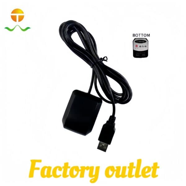
A professional Dual Frequency GPS Receiver offers unmatched reliability. Specifically, it tracks signals from two different frequencies at once. It utilizes both L1 and L5 bands for better data. This dual-approach helps the system cancel out ionospheric errors. Furthermore, it significantly reduces multipath interference from tall buildings. Most high precision surveying equipment now relies on this tech. Consequently, you achieve a fixed solution much faster today. Reliability in the field depends on these advanced signal layers. Every frequency adds a layer of safety for your team. Modern engineering makes centimeter accuracy a reality for everyone. You can work in places where others simply fail.
The Power of L1 L5 Dual Band GPS for Surveyors
Why is L1 L5 dual band GPS for surveyors so critical? Specifically, the L5 signal is much stronger and cleaner. It pierces through heavy foliage and urban obstructions easily. Therefore, you maintain a signal where single-frequency units die. Furthermore, the receiver compares both signals to fix errors instantly. Consequently, your data remains clean even in messy environments. This speed is essential for high-stakes infrastructure projects. Most experts find this technology absolutely necessary for 2026.

Achieve Centimeter-Level Perfection in Every Mission
Imagine a world where your GPS never loses its lock. You want a tool that survives every environmental challenge. Using a centimeter level accuracy GPS module makes this real. You no longer worry about expensive delays or drifts. Instead, you enjoy a stable and predictable workflow daily. Experience the professional pride of a perfectly mapped site. Your clients will trust your surveying data more than ever. Better hardware leads to a much stronger market reputation. Premium receivers turn a difficult job into a simple task. You deserve the best technology that 2026 currently offers. Reach new levels of success with dual-frequency power.
The Benefit of Multi Constellation GNSS Receiver Support
Modern surveying requires more than just American GPS satellites. Specifically, a multi constellation GNSS receiver tracks every available system. It uses GLONASS, Galileo, and BeiDou for total global coverage. Therefore, you always have enough satellites for a solid fix. Furthermore, the receiver switches between constellations to find the best signal. Consequently, your downtime is almost zero in any location. This global reach is vital for international surveying firms. It ensures your equipment works anywhere on the planet.
Secure Your High-Precision Future Today
The 2026 surveying market demands the highest accuracy standards. Do not settle for “close enough” in your professional work. Explore our latest Dual Frequency GPS Receiver models now. We offer specific solutions for drones, tractors, and handhelds. Our shop provides full technical support for every client. Furthermore, we offer a centimeter level accuracy GPS module kit. Improve your data quality and lower your risks today. Take the first step toward a more reliable workflow. Contact our precision experts for a personalized quote today.
Ready for Absolute Accuracy in the Field?
-
Evaluate your current signal loss rates this week.
-
Check out our high precision surveying equipment catalog.
-
Browse the latest L1 L5 dual band GPS for surveyors.
-
Inquire about our multi constellation GNSS receiver specs.
-
Start your journey to absolute precision tonight.
Visit our official site to browse our receiver gallery. Find the perfect balance between power and extreme accuracy. The future of your project depends on your GPS data. Contact us today to secure your ultimate surveying solution!

Precision is the Only Way Forward
In 2026, we value accuracy and efficiency above all else. A high-quality Dual Frequency GPS Receiver is a vital tool. It protects your reputation and ensures project success. Make your surveying as sharp as your own professional vision. Your best results begin with the right dual-frequency tech.
Case Study: Precision Agriculture in the Brazilian RainforestA large farm used autonomous tractors for planting seeds. They worked near a dense forest edge with heavy canopy. Single-frequency GPS often lost signal under the thick trees. This caused the tractors to skip rows and waste land. The farm then installed a multi constellation GNSS receiver. This unit tracked GPS, Galileo, and BeiDou signals simultaneously. Furthermore, the dual-frequency tech maintained accuracy under the leaves. Consequently, the planting was 100% accurate across the whole field. Crop yields increased because the rows were perfectly spaced. |